
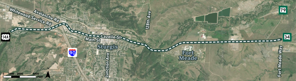
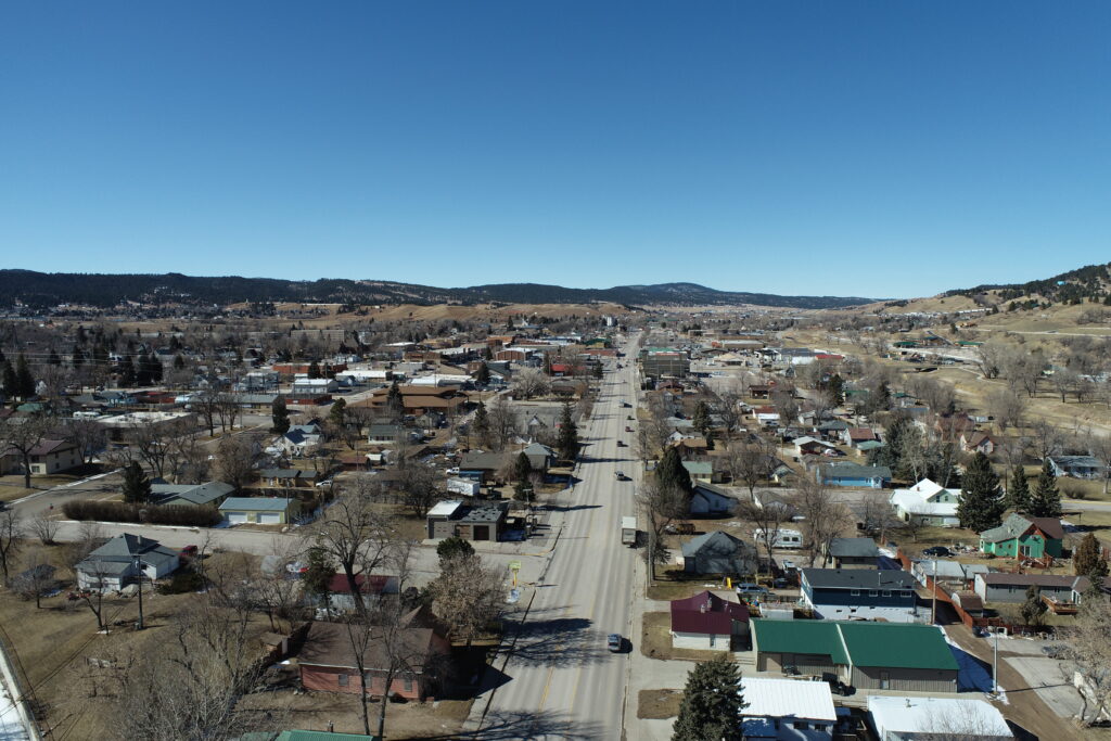
A corridor planning study is being performed for a portion of the US Highway 14 Alternate (US14A) / SD Highway 34 (SD34) corridor in Meade County, SD, also known as Lazelle Street in Sturgis, SD.
The purpose of this study is to evaluate existing and future conditions of the corridor and potential improvements related to roadway conditions, traffic operations, and safety.
Project Area
The study corridor begins at the west city limit of Sturgis and continues east to Fort Meade Way. The study corridor includes:
- US14A, from the west Sturgis city limit to the I-90/SD34/SD79 (Exit 30) junction within Sturgis;
- SD34, from the Exit 30 junction to the east Sturgis city limit east of Blanche Street; and
- SD34, from the east Sturgis city limit to the intersection with Fort Meade Way east of Sturgis.
There are 22 intersections included in this corridor.
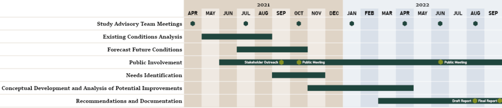
The South Dakota Department of Transportation (SDDOT) assembled a Study Advisory Team (SAT), comprised of representatives from SDDOT, City of Sturgis, Meade County, and Federal Highways Administration, to guide the development of the corridor study.
Project area stakeholders and the public will be invited to provide input on the study and recommended improvements.
Work on the corridor study began in spring 2021. Additional information about the project will be made available as the project progress and in advance of the first public meeting, anticipated to occur in fall 2021.
Sign up for project updates
Enter your contact information to be notified about opportunities for public input and periodic project updates.
Contact
Steve Gramm
SDDOT Project Manager
Steve.Gramm@state.sd.us
Mike Malone
Consultant Project Manager
mmalone@jeo.com